Abstract
In the Philippines, traffic is unavoidable. Through this study, we address this by determining the response of traffic flow to rain in Pasig City. Weather features were scraped from the TimeandDate weather API and WorldWeatherOnline websites. With help from Thinking Machines and the Waze Connected Citizens Program, externally sourced Waze data was used to extract transport-related features. The traffic data was segmented into 700 square blocks with corresponding latitude and longitude using vector representation. Each block had derived traffic features such as average speed, number of traffic jams, portions of road. Feature engineering was done to derive additional features such as the amount of rainfall in different time spans. This was done to examine the effect of weather features for each block at different times. The main proponent of this study is clustering these blocks to generate data-driven insights for stakeholders such as the Pasig City local government and the Metro Manila Development Authority (MMDA). Additionally, dimensionality reduction was done to extract significant features from each cluster.
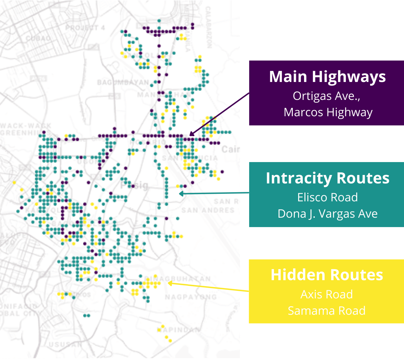
We identified 3 main clusters according to traffic volume and road type in Pasig City, revealing various congested locations.
Cluster 1: Major Highways includes roads that guarantee you the fastest route with the highest potential speed. However, with the high volume of traffic and the route’s length, most people will be significantly delayed along this route.
Cluster 2: Intracity Routes contains roads that are ranked second in terms of weather-related delays, congestion, and speed. Most of Pasig’s areas fall into this category which indicates high urban congestion within the roads.
Cluster 3: Hidden Routes upon initial glance has roads which have the lowest maximum speed in the area that make them appear unpromising. However, they seem to be the smoothest and least congested routes. The majority of these are in the outskirts of Pasig City.
Finally, our recommendations include (1) increasing infrastructure capacity especially in Cluster 1 (Major Highways) to help in decreasing overall congestion especially during severe weather since these are main thoroughfares, (2) crafting long-term urban planning policies for Cluster 2 (Intracity Routes) as points of interests such as commercial and public spaces are included here, and (3) rerouting some traffic volume from Cluster 1 to Cluster 3 (Hidden Routes) may help in augmenting the congestion within the city during the rush hour.


