
Abstract
Metropolitan Manila has been known to have among the worst traffic in the world, mostly due to poor urban planning caused by quick urbanization. In finding a solution to traffic, the government faces a resource allocation problem due to limited funds, and citizens face a path finding problem. As such, there is great value for both the government and path finding algorithms to further understand the road network of the Philippines.
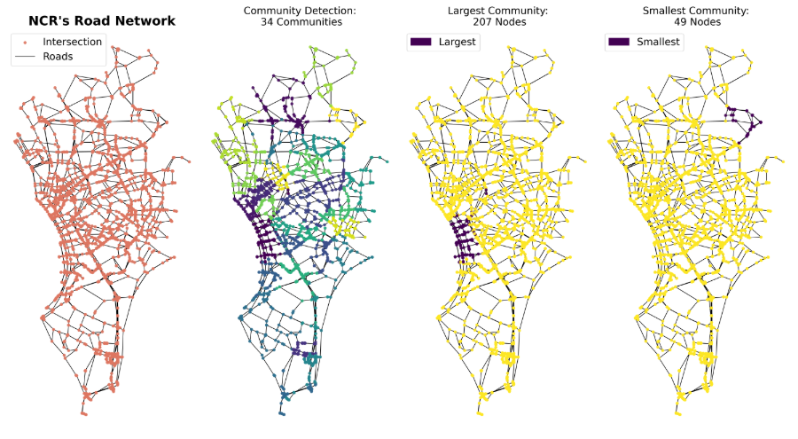
The study utilizes the Open Street Maps (OSM) database to access Philippine roads, limited to secondary roads or greater. It is then exported as a network using OSMNx, where the roads are the edges, and the nodes are the intersections. Using NCR’s Road Network Statistics, the research was able to show that there is at least 25 Roads needed to be driven in order to arrive in any specific place within NCR. The research was able to show also that there are 34 Communities formed in NCR using the Louvain Method. Through the Road Network Structure, the research was able to pinpoint that the best centrality measure to use for the NCR is the closeness centrality.
Also using the Methodology, the research was able to recreate the Popular Driving Guidance App, Waze, that resulted in identical results in terms of total length, total time, and visual pathway to traverse. The research also discusses how Traffic Uncertainties which are delays caused by roadblocks. It was found that in Makati, the average detour delay due to a roadblock is 52 seconds, with Kalayaan Avenue having the worst delay at 82 seconds.
With this research, Proper Understanding of NCR’s Road Network is easily doable and will pave a way for the creation of a data-driven strategies to improve the Philippine Traffic Situation.