
Abstract
Essential in designing efficient and robust road networks is an understanding of how traffic flow is explained by the structure of its road network and its traffic robustness to road closures. This study aims to (1) predict traffic flow in the main thoroughfares of Metro Manila based on road centrality and temporal features and (2) to simulate the traffic robustness of the network to road closures.
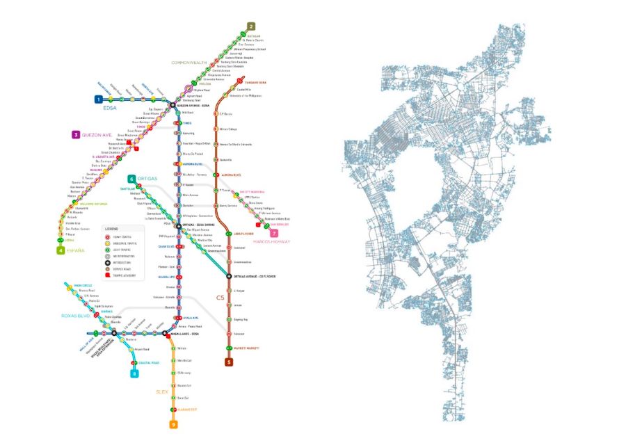
Using a one-week dataset, traffic conditions (Light, Moderate, and Heavy) on specific locations monitored by the Metropolitan Manila Development Authority (MMDA) at any time of the day was predicted using average degree, closeness, and betweenness centrality values of its surrounding roads. Results indicate that gradient-boosted tree method (GBM) for northbound and southbound traffic flow could predict with 89.5 and 88.9% accuracy, respectively, vis-a-vis a 41% random guess accuracy. In addition, the average centralities of surrounding roads are the most significant predictors of traffic flow.
Moreover, results of the network attack simulations indicate that the road network reinforce the notion of Braess’ Paradox – which states that counterintuitively, the closure of roads does not necessarily impede traffic flow rather road closures could potentially improve traffic conditions. The study can be used by urban planners and transportation engineers to assess the impact of addition or closing of roads on traffic flow, thus aiding in the design of efficient and robust road networks.